Sai Kung and the Geopark
An hour out, Hong Kong’s back garden — a fishing town selling seafood off sampans, a UNESCO geopark of hexagonal volcanic columns, and beaches the postcards don’t tell you need a hike or a boat.
The short version
- The route runs MTR to Choi Hung (minibus 1A) or Hang Hau (minibus 101M) plus a 25–40-minute ride into Sai Kung town — cash or Octopus, turn-up frequency — landing at the waterfront where the day organizes itself.
- The sampan seafood trade is the town’s signature: boats moor along the promenade selling the morning’s catch over the gunwale — point, bargain, and carry your bag to a seafood street restaurant that cooks what you bought, or order off the tanks directly per the street’s standing custom.
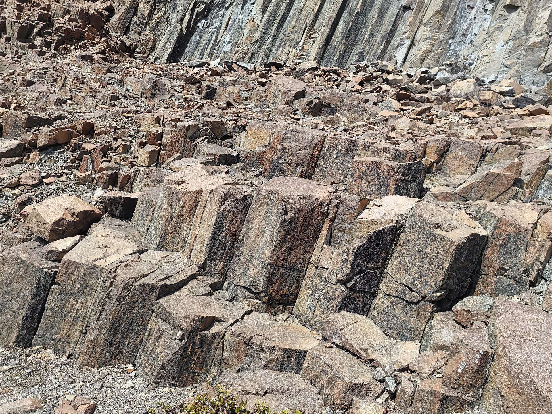
- The UNESCO Global Geopark is the alarm’s geology lesson: Sai Kung’s volcanic coast holds hexagonal rock columns — cooled volcanic tuff in colossal organ-pipe stacks — with the High Island Reservoir East Dam as the accessible showcase (geopark.gov.hk), reached by taxi from town or a long exposed walk.
- Tai Long Wan — the wild white-sand bay on the peninsula’s far side — carries the alarm’s honesty: no road reaches it; the MacLehose Trail’s sections deliver it in a few sweaty hours, or the town’s speedboats sell the shortcut, and the surf beach at Ham Tin repays either investment.
- The island-hopping tier fills gentler days: kaito ferries and charter boats from the promenade serve Sharp Island’s tombolo sandbar and the harbor’s islets — the family-grade version of the coast.
- The MacLehose Trail’s first two sections begin here for the committed — the reservoir’s dam walls, the volcanic coast, and the ridgelines that made the trail’s name — with water-carrying per the alarm as the non-negotiable kit rule in every season.

Getting there
The MTR-minibus combination is the local default and faster than it reads; taxis from Hang Hau fill the gaps. In town, everything radiates from the waterfront: seafood street behind it, kaito piers along it, and the taxi rank for the East Dam run (agree the return pickup — the dam has no rank). The geopark’s showcase is genuinely remote-feeling for somewhere an hour from Central, which is the whole draw and the whole logistics problem in one.
The day
The waterfront opens it: sampans hawking the catch, the tanks along seafood street auditioning lunch, and the promenade’s unhurried register setting the pace. The East Dam takes the early afternoon per the alarm: the taxi out along the reservoir, the sea-cave viewpoint, and the hexagonal columns stacked six-sided and enormous where the dam meets the coast — volcanic geometry that reads engineered and isn’t. Back in town, the choice: a kaito to Sharp Island’s sandbar for the easy swim, or — for the committed version planned from the morning — the Tai Long Wan expedition by trail or speedboat, surf and empty sand at the price the alarm quoted. Dinner happens where lunch did, with the day’s second seafood argument, and the minibus-MTR chain runs you back into the city’s noise an hour later.
When to go
October through April runs the walking weather — the East Dam and MacLehose sections want exactly this window — while summer swaps hiking comfort for swimming warmth and typhoon-season volatility: beach days work, trail days sweat, and the weather signal system is the morning check. Weekends fill the seafood street and the kaito queues with the city’s own escape traffic; midweek returns the town to its fishing rhythm. The columns and the bays don’t care about the calendar, which is the geopark’s quiet advantage.
Frequently Asked Questions
How does the sampan seafood thing actually work?
Boats sell over the side at the promenade — point at what moves, agree a price (weighing happens on board), and carry the bag to a restaurant that cooks purchases for a fee, or skip the boat and order from a restaurant’s own tanks. Typhoon shelter classics — steamed grouper, garlic scallops, pepper-salt mantis shrimp — are the canon. It’s theater and commerce at once, and the theater is free.
What made the rock columns?
A supervolcano’s caldera around 140 million years ago: thick volcanic tuff cooled slowly and cracked into hexagonal columns — the same physics as Giant’s Causeway, here at far larger column scale. The East Dam section puts them at arm’s length beside the sea caves. The geopark listing protects the coast and explains it with good signage.
Can I really get to Tai Long Wan and back in a day?
Yes, by either honest route: the trail (a few hours each way from the road at Sai Wan Pavilion, shorter than the full MacLehose approach) or the speedboat from town, with many walkers boating one direction. The bay has basic beach shacks and no other infrastructure — water, sun cover, and the return plan per the alarm are the kit.
Is Sai Kung town worth it without the expedition?
Fully — seafood street, the promenade, Sharp Island’s easy sandbar hop, and the town’s unhurried register make a complete gentle day. The geopark and wild beaches upgrade it to spectacular for those who spend the extra effort, but the fishing-town core is the reliable product.
Sai Kung or Lantau from Hong Kong?
Lantau (documented on this network) for the Big Buddha, the cable car, and the organized version of Hong Kong’s wild side; Sai Kung for seafood, geology, and beaches that make you work. Spectacle versus back garden — and Lamma Island (also documented on this network) sits between them in effort, which is the plain three-way sort.